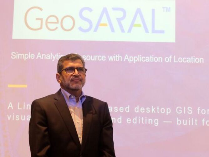
Esri India has launched GeoSARAL, a Linux-based desktop GIS software aimed at users who need essential capabilities such as mapping, visualization, querying and editing. The solution is positioned as a cost-effective and streamlined option for everyday GIS tasks, particularly for users who do not require the advanced capabilities of ArcGIS Pro. Agendra Kumar, Managing Director, Esri India, said the product has been developed keeping customer requirements and the growing adoption of Linux in India in mind.
“Innovation with customer needs in mind has been at the heart of our technology journey. The launch of GeoSARAL is a significant milestone. Initial users of GeoSARAL are very appreciative to have a cost-effective Linux-based desktop GIS software for mapping, visualization, editing and querying. It works effectively within ArcGIS environments for these tasks, addressing the simple GIS needs of some users, while others work with more advanced ArcGIS Pro capabilities. GeoSARAL is supported on both Linux and Windows, with support for Android on its way,” Kumar said. According to Esri India, Linux has a 16.2% desktop market share in India, the highest in the world, while globally Linux desktop adoption is growing at more than 20% CAGR, Kumar said.
Why did Esri India develop GeoSARAL for the Linux desktop?
Kumar said GeoSARAL was developed to address the growing demand for Linux-based GIS capabilities in India, while also providing existing ArcGIS users with a cost-effective solution for everyday GIS tasks: “Why did we do that? Because demand for Linux is growing. Linux desktops are very popular in India, with Linux having a 16.2% desktop market share in India, which is the highest in the world. This market share is higher than that of the US, Germany and France combined. So, it is a unique position where Linux is very highly used in the country. Globally also, Linux desktop is growing at a CAGR of more than 20%. That’s another reason why building something on Linux is important.”
He added: “ArcGIS Pro is a desktop GIS system, but it is supported on Windows. Our ArcGIS users are looking for a low-cost, streamlined solution for simple GIS work such as mapping, visualization, editing and querying. So, we wanted to fulfil that demand from Indian customers.
“We decided to develop a product that works with Linux and, of course, with Windows as well. We wanted to provide a good user interface so that users have a very good experience with the product, along with the features that are useful for our key market stakeholders. GeoSARAL can become a part of the existing ArcGIS infrastructure. It can work as a standalone product without internet connectivity and can be used on Linux desktop systems, Linux laptops and desktop computers. Eventually, when Android support is available, it can also be used on mobile devices such as tablets and phones.”
Kumar said the India-specific approach behind GeoSARAL also extends to how the solution connects with Esri India’s existing data and ArcGIS ecosystem. He explained that the product is designed to serve a wider base of users within organisations, including those who need basic GIS capabilities rather than the more advanced functions of enterprise GIS platforms.
“The idea is also to align this with the Indian context and address the broader objectives that we have in the country. If somebody wants to access information available in ArcGIS, we have a Living Atlas where a lot of open data is hosted by us. We host it in India. We call it Indo ArcGIS Living Atlas. We have a huge repository of data which is receiving 6 to 8 million requests every month on that platform. It is hosted right here in India. If somebody wants to use ArcGIS Online or their own enterprise portal, they can log in and access that as well. So, the idea was to provide the functions that people need,” he added. He also stated that in many organisations, ArcGIS is used by people who are doing advanced analytics, running AI, doing cartography and carrying out other such activities. However, there can be another set of people who do not perform these tasks and only need to carry out simple GIS activities.
He said: “They can now use GeoSARAL on their own machines, which are not so expensive and are easily available. They can do what they need to do without having to use a very large product. From a business perspective, it addresses a well-defined customer base that is already using ArcGIS products, both Enterprise and Pro. It also addresses the operational challenge arising from the absence of a Linux-based GIS desktop solution. ArcGIS Enterprise works on Linux, but ArcGIS Pro does not. GeoSARAL provides seamless integration with the existing ArcGIS ecosystem and enterprise security models and can interact with the data that is already there as part of the same ArcGIS ecosystem. So, this is the business value proposition.”
What are some of the enterprise use cases for GeoSARAL?
Kumar said the solution can support a range of basic location-based activities for private sector organisations, particularly where teams need to create, update and query maps and datasets: “Mapping is an important use case for a private sector organisation. Once they have data, they can use GeoSARAL for creating maps, making changes to them and making queries. They can use it for all these basic activities. We also have a large data repository in the form of Living Atlas and other products that we have. We have ArcGIS Business Analyst. Because GeoSARAL can become a part of the ArcGIS ecosystem, it can also connect with the data available in other ArcGIS systems.”
The software, he added, also provides an editing environment for creating, modifying and deleting geographic features, updating attributes and maintaining spatial accuracy through snapping support. Esri India said the product was tested with customers before its launch and received positive feedback: “We gave some copies to our customers and got very positive feedback from them. So, we decided to launch it because now it is a product which has been tested, pre-tested and is ready.”
Is geospatial technology becoming critical infrastructure for enterprises?
Kumar said enterprises are increasingly recognising geospatial technology as a critical component of their business infrastructure, with its role expanding across sectors such as retail, cement, steel, automobile manufacturing and insurance: “Most of them have realised now that geospatial technologies are key to their success. We have a good presence and are getting good business from cement companies and retail organisations. If you look at the retail infrastructure today, quick commerce works on mapping. So, there is a realisation that without mapping, you cannot deliver anything. I think that realisation is also coming to other organisations, such as steel companies, automobile companies, different kinds of manufacturing companies and insurance companies. So, it is becoming a fairly critical technology.”
Kumar also pointed to the growing integration of geospatial technology with enterprise applications, allowing organisations to combine location-based information with data already residing in their business systems: “The best thing is that our ArcGIS product integrates with many other IT technologies. It integrates with Salesforce, SAP and Oracle. Because it becomes a part of that kind of infrastructure, using our technology alongside those IT systems is very easy. Whatever data they have in their SAP or other ERP systems can be brought into ArcGIS for analytics. It also seamlessly integrates with some of the other BI tools. It can coexist with BI tools and provide a solid mapping platform to people who are using BI.”